by bugking88 via AdobeStock
Activity #1 Participatory Watershed Land-use Management (PWLM) Methodology Training
Description of Activity
- Purpose: enable local government agencies (Laguna Lake Development Authority (LLDA) and Local Government Units (LGUs) to apply/use PWLM methodology.
- Process: provide training for PWLM guidelines and using the toolkit.
- Outcome: Trainees can use PWLM methodologies and contribute to the development of local climate change adaptation and DRR policies.
Training Material
PWLM guidebook and toolkit
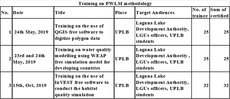
The PWLM methodology guidebook consists of the following four steps: (i) scenario analysis, (ii) risk assessment, (iii) CCA measure development, and (iv) development of local climate change action plan (LCCAP) and improvement of comprehensive land-use plan (CLUP) with an impact assessment toolkit, including tutorials for free software such as QGIS, WEAP, InVEST, and HEC-HMS/HEC-RAS.

Evaluation
What was accomplished?
Conducted training for use of the digitised future land-use map, water quality modelling, and habitat quality modelling, through utilisation of free software (QGIS, WEAP and InVEST), which were provided to LLDA and LGUs officials in the five target watersheds in Laguna De Bay.
What is the issue?
Follow up activities are needed in order for LLDA and LGUs to conduct independent impact assessments. The results will be reflected in their policies, including LCCAP and CLUP.
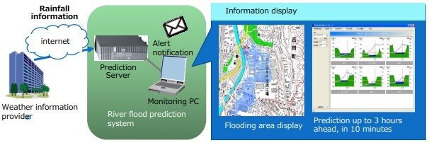
Training on flood modelling using free software HEC-HMS/HEC-RAS will be provided to LLDA and LGUs officials in the five target watersheds in Laguna De Bay
Technical reference
- QGIS free software
- WEAP free software
- InVEST free software
- HEC-HMS/HEC-RAS free software


