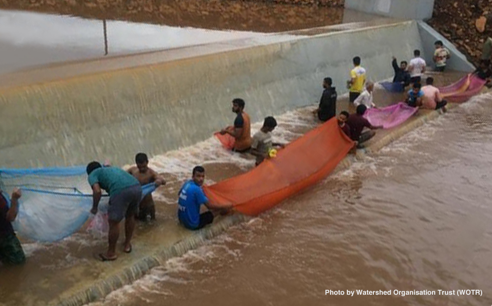
Climate change impacts
Morgan County, Utah, is located in a desert region surrounded by mountains, where agriculture and dairy farming are not highly productive due to the lack of water flowing from the mountains into irrigation reservoirs. As global warming causes more precipitation to fall as rain instead of snow, there are concerns that the amount of water available to agricultural producers may decrease every season.
Adaptation activity
In recent years, the U.S. Department of Agriculture (USDA) has been working to promote the use of weather and climate data to reduce risks to agricultural production. In a long-term collaboration with USDA's Natural Resources Conservation Service (NRCS), farmers in Morgan County agreed to install soil-climate-analysis-network (SCAN) facilities on their farms. In addition to hourly readings of soil moisture and temperature 2, 4, 8, 20, and 40 inches below the ground surface, data on temperature, solar radiation, relative humidity, wind speed, wind direction, and precipitation are recorded and stored (Fig. 1 & 2). Depending on the farm’s location, the data is transmitted to a database via a commercial cellular data transmission network (Fig. 3, Note 1), meteor burst communication technology (Fig. 4, Note 2), or satellite systems. With immediate access to SCAN data, farmers can determine the optimal time to water their crops.
Over the last ten years, the NRCS National Water and Climate Center and the National Soil Survey Center have collaborated with NRCS state branch offices to establish more than 400 SCAN facilities throughout the United States, with 38 in Utah. The sites were determined using geographic data systems. The procedure for establishing a site is for local NRCS conservationists to contact possible candidates for the scheme and reach an agreement to install a SCAN facility on the collaborators' land.
Outputs / Expected benefits
SCAN data are expected to help optimize water use by taking out the guesswork of when water is needed. Feedback from one farmer was that they had had their best corn harvest since using the technology.
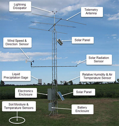
Fig. 1 SCAN automated data collection facility
(Source: National Water and Climate Center "Automated Soil Climate Monitoring”)

Fig. 2 Soil Moisture and Temperature sensors
(Source: National Water and Climate Center "Automated Soil Climate Monitoring”)
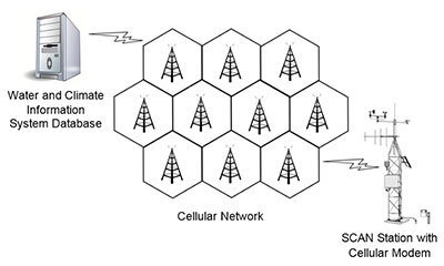
Fig. 3 Cellular data transmission network
(Source: National Water and Climate Center "Data Acquisition Technology”)
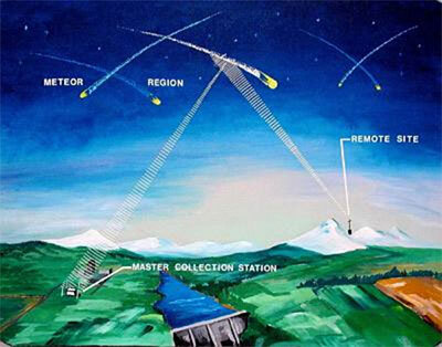
Fig. 4 Meteor burst communication technology
(Source: National Water and Climate Center "Data Acquisition Technology”)
Footnote
(Note 1) Technology in which voice, text, and digital data are transmitted by radio waves through a global network of transmitters and receivers.
(Note2) Communication technology for transmitting and receiving data in near real-time using the reflection of radio waves by ionized electrons generated by meteor activity.