Left: Photo Credit: Cape Cod Landsat 7 - Cape Cod - Wikipedia
Right: Image credit: Shannon1. CC BY 3.0, https://creativecommons.org/licenses/by/3.0/deed.en, via Wikimedia Commons.
Climate change impacts
Cape Cod (Fig. 1), which forms the eastern edge of Massachusetts, is a low-lying peninsula with a long shoreline that is prone to flooding. Factors that increase this risk include sea level rises due to nor'easters (Note 1), extratropical cyclones, heavy rainfall associated with hurricanes, high waves, storm surges, and global warming. Many of the low-and middle-income properties in Barnstable County, which covers the entire cape, is located in low-lying areas that are vulnerable to tides and are at an increased risk for flooding. According to NOAA tide gauge at Woods Hole, Massachusetts (Note 2), the tide level has risen by more than 9 inches (about 23cm) since 1932.
Adaptation activity
Residents of Barnstable County and 15 other local authorities in the United States have been able to insure their assets against flooding damage with the National Flood Insurance Program (NFIP) for some time. However, an issue with the system is that premiums charged by the NFIP were not sufficient to cover flood damage risks to buildings that were constructed prior to the establishment of the program (Note 3), leading to an increase in premiums. To minimize the increase in premium costs, local authorities are attempting to reduce future premiums and flood risks through the United States Federal Emergency Management Agency’s (FEMA) Community Rating System (CRS). Local authorities can earn CRS credits by enforcing robust building standards and ensuring the maintenance of flood plains, helping to lower flood insurance premiums for the community.
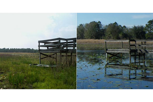
The CRS Coordinator’s Manual (Note 4) has more than 600 pages. Due to the complexity of the system and limited human resources in cities and towns, Barnstable County officials hired a regional CRS coordinator. Rather than undertaking new projects such as expanding drainage channels or the construction of new buildings, the coordinator recognized the possibility to quickly acquire CRS credits by making modifications to existing projects. One example of this is mosquito control. During the winter in Barnstable County, 26 mosquito control personnel remove debris such as branches, leaves, mud, and sediment from 1,500 miles (approximately 2400km) of gutters and sewer pipes, ensuring rainwater drainage, and reducing the number of mosquito breeding sites (Fig. 2). This type of rainwater channel management is also effective for flood mitigation. By examining the situation, the coordinator and an assistant superintendent for the Cape Cod Mosquito Control Project realized that 15 municipalities could earn CRS credits by digitally mapping this annual channel maintenance (Note 5).
Residential property owners are able to reduce their premiums by 5-45% when communities earn CRS credits for reducing flood risk.
Outputs / Expected benefits
This approach is expected to lower flood insurance premiums and strengthen resilience to climate change.
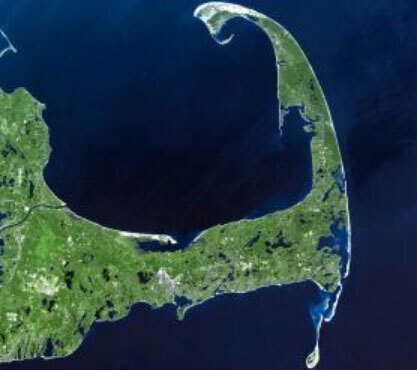
Photo Credit: Cape Cod Landsat 7 - Cape Cod - Wikipedia
Fig. 1 Cape Cod Peninsula extends from southeastern Massachusetts into the Atlantic Ocean
(Source: U.S. Climate Resilience Toolkit "County-Wide Collaboration Reduces Flood Risks and Insurance Rates”)

Image credit: Shannon1. CC BY 3.0, https://creativecommons.org/licenses/by/3.0/deed.en, via Wikimedia Commons.
Fig. 2 Water channel maintenance
(Source: U.S. Climate Resilience Toolkit "County-Wide Collaboration Reduces Flood Risks and Insurance Rates”)
Related Information
KEYWORDS
- # Case Study
- # Coastal Areas
- # Infrastructure
- # Life of Citizenry and Urban Life
- # Natural Disasters
- # Water Environment/Water Resources
- # Adaptation Action/implementation
- # Adaptation Business
- # Adaptation Funding/Finance
- # Disaster Prevention/Disaster Mitigation
- # Impact Assessment/Risk Assessment
- # North America
- # United States
- # 2021


